Lancaster’s Amtrak station “is really something special,” Michael Domin said.
The area surrounding it, not so much.

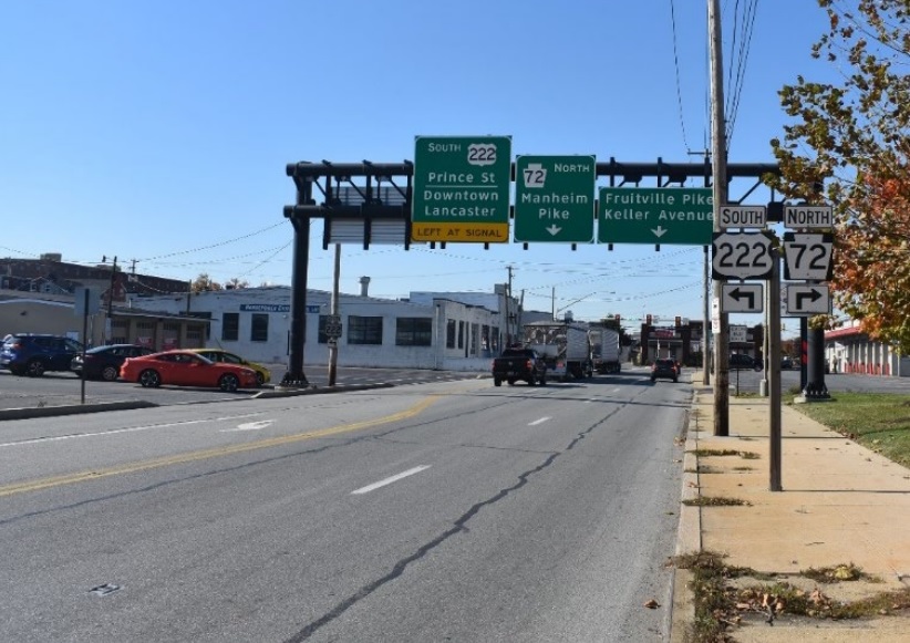
The station, which is listed on the National Register as part of Lancaster’s Historic District, sits amid a sea of parking lots, vacant lots, blighted former industrial properties and vehicle dealerships.
Domin and his colleagues would like that to change. He is principal planner with the Lancaster County Planning Department, which is finalizing a “small area plan” for the station’s immediate neighborhood.
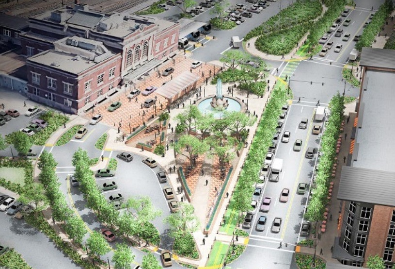
On Tuesday, the department held an open house on the draft plan at nearby Ross Elementary School. It envisions a remarkable transformation. The station, it suggests, should be the centerpiece of “a cohesive and well-designed urban gateway neighborhood.
The goal would be to implement the principles of transit-oriented development, which call for creating dense, walkable, mixed-use communities around “prime mobility hubs” to reduce car dependence and promote sustainability.
The area is ripe for redevelopment, the plan says, noting nearby projects in the works such as The Yards apartment complex planned at the intersection of Lititz Pike and Marshall Avenue.
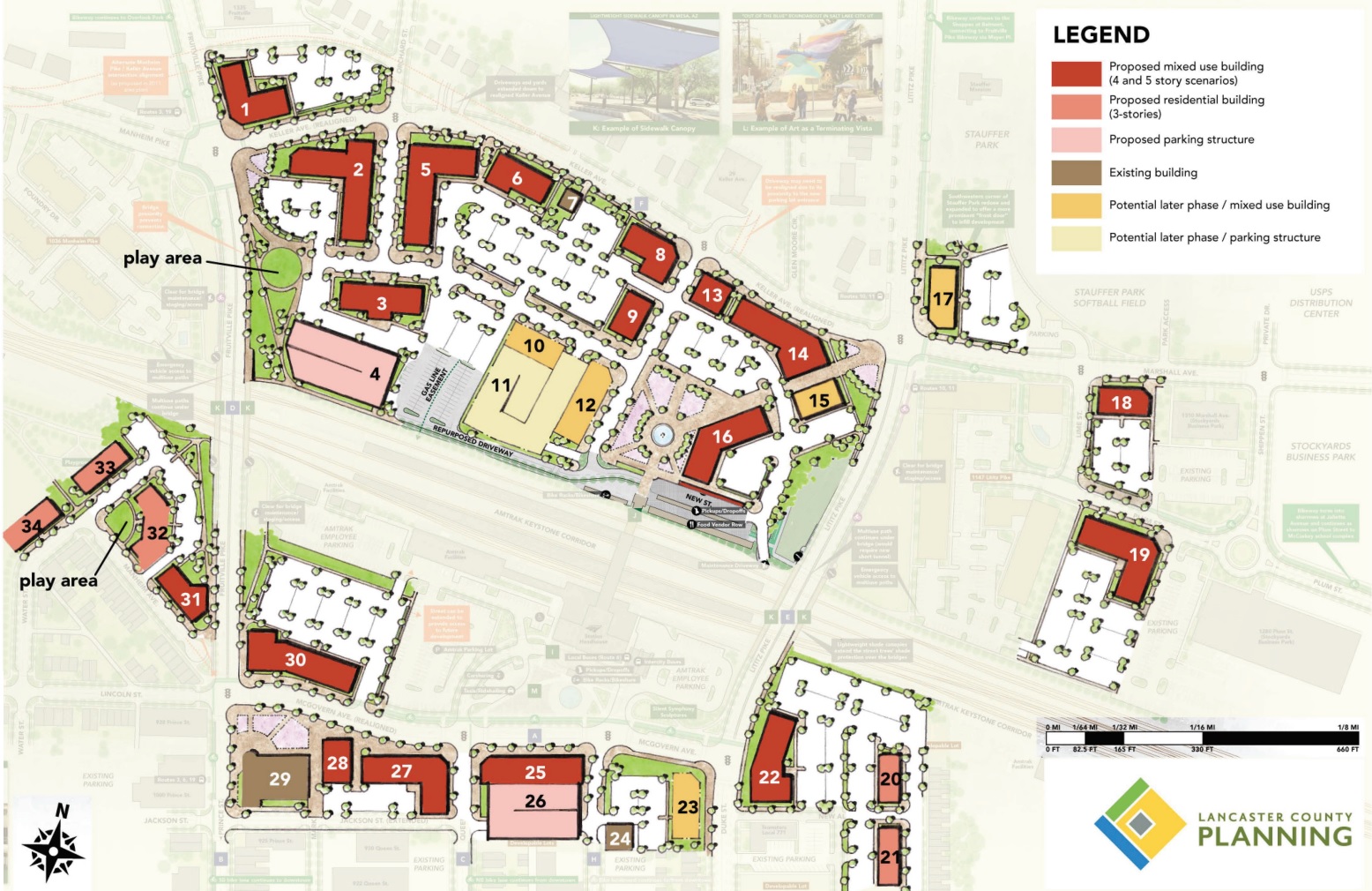
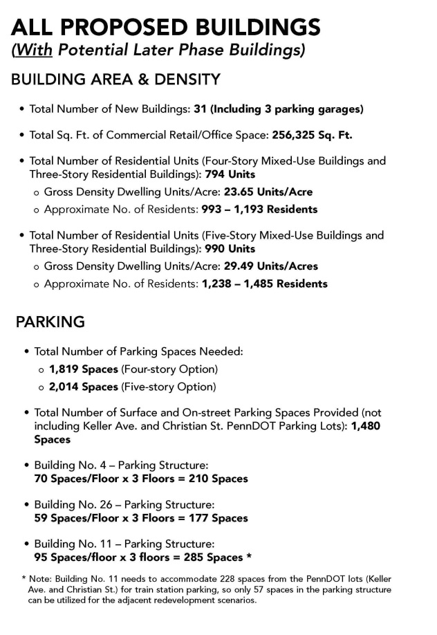
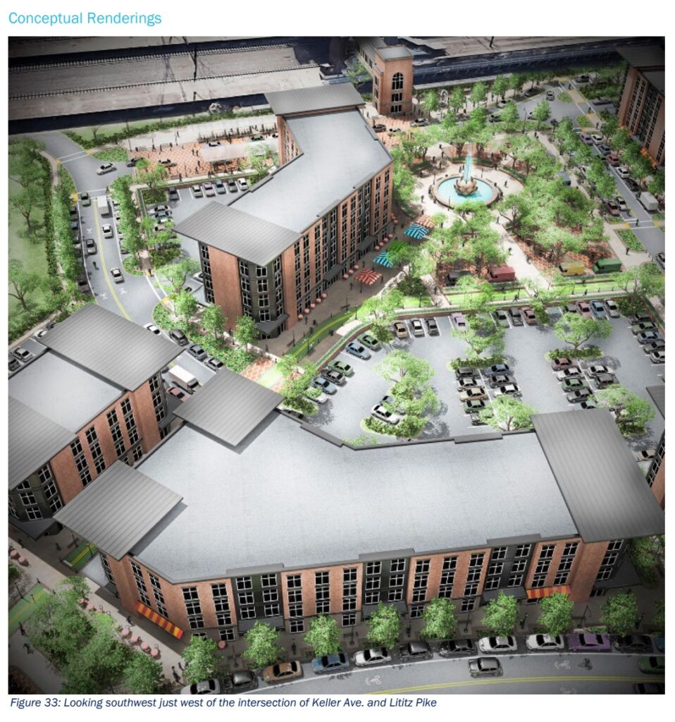
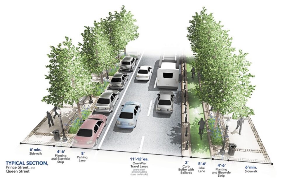
The draft plan lays out the possibilities. A compact layout of three-story five-story buildings would offer ground-floor shopping and retail and housing for as many as 1,500 people. There would be plazas, small “pocket parks” and linear “finger parks” and tree-lined sidewalks and bicycle lanes.
Nearby intersections would be realigned. McGovern Avenue in front of the train station would be narrowed. Traffic patterns would be reimagined to promote safety for all users: pedestrians, cyclists, cars and buses.
The benefits would be felt countywide, Domin said. Lancaster County is in the midst of a housing crisis: If it can maximize its use of areas like the zone around the train station, that will reduce development pressure on its farms and rural land.
Getting there from here
The challenges, however, will be formidable. The area around the train station is divided between two municipalities, Lancaster city and Manheim Township. Their zoning and land development rules have significant incompatibilities — an impediment for projects seeking to work across the boundary between them.
Much of the existing zoning around the station allows uses such as gas stations or manufacturing that would be at odds with the transit-oriented vision. Particularly on the Manheim Township side, there are rules on building height, lot size, setbacks and so on that prevent the kind of residential density the Planning Department sees as optimal around the station — about 19 to 30 units per acre.
Then there’s the task of getting the area’s property owners on board and making it worthwhile for private-sector developers to invest. Domin said the planning team has been in contact with the larger landowners, and that they’re been open to the ideas being presented.
The draft plan calls for close collaboration with entities like the Economic Development Co. of Lancaster County, which can make low-interest loans and other state-supported financing tools available.
There are two public landowners involved: Amtrak and the state Department of Transportation. PennDOT owns about 4 acres on the north side of the station, where it is building a 240-space parking lot for Amtrak, with a pedestrian bridge crossing the tracks and connecting to the existing one.
The land was part of the nearly 11-acre Host Town Hotel site. The other 7 acres belong to the Deerin Cos., a local real estate investment company.
Share your thoughts
The Lancaster County Planning Department is accepting public feedback on the Lancaster Train Station Small Area Plan through Sunday, April 9.
To submit comments, use this online form.
What’s next?
Once the draft plan is finalized, Manheim Township and Lancaster will be invited to adopt it. The department recommends that they then create an intergovernmental committee to work on implementation.
The best way to harmonize their regulatory differences would be to create a new transit-oriented zoning district, the draft plan says. Manheim Township and Lancaster would adopt it independently, creating a unified regulatory framework across their shared border.
The ordinances might not be precisely identical, as long as they meshed and enabled the broader vision to move forward, Lancaster’s Director of Community Planning and Economic Development Chris Delfs said.
The draft plan features multiple site plans and “conceptual renderings.” They’re intended only as general illustrations of what’s possible, Domin said: Actual development could be much more variegated and incremental and still achieve the desired transit-oriented goal.
Creating the necessary framework won’t be a short process, he said. In all, it will be at least a decade, and likely longer, before a transit-oriented project takes shape near the station.
“Hopefully, we have the patience to wait,” he said.